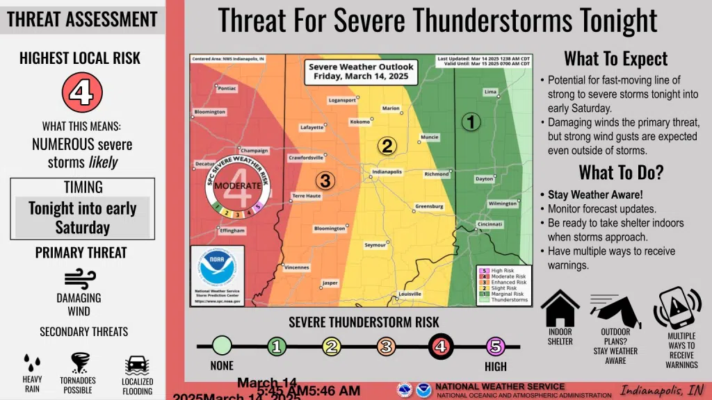
Thunderstorms, tornadoes, and high wind gusts are all possible in Indiana both Friday night and for portions of Saturday.
“The primary threat where we think the risk for tornadoes is greatest in the area is going to be over the lower Wabash Valley like from Terre Haute down to Vincennes,” said Mike Ryan, meteorologist with the National Weather Service in a Friday afternoon news briefing.
Ryan says the bulk of the state needs to be most concerned about damaging winds which could reach as high as 55 mph.
“Although, we can’t rule out at least a few tornadoes and maybe even some large hail,” said Ryan.
As for the timeframe, Ryan believes storms could be the worst between 1 am and 7 am Saturday.
“We will also be dialing up a wind advisory for most of the state that will last between 7 pm this evening and 4 pm tomorrow,” said Ryan.
Rain is likely to fall, but Ryan believes the highest amounts of rain will be roughly 1 to 2 inches.


Comments